Islands around Oludeniz
Our Islands… St Nicholas and Karacaoren
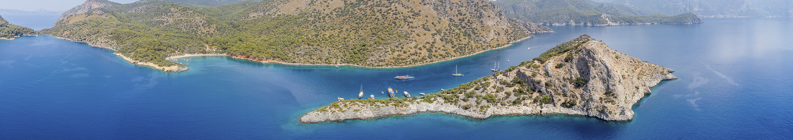
There are two islands which lie in close proximity to the mainland on the western side of the Oludeniz Bay.
They are large grey limestone elevations rising out of the sea.
Through the centuries wild garlic, thyme, grasses and bushes have rooted themselves into their rocky crevices. Probably used as an anchorage in earlier times, it was Christianity that brought a permanent settlement, quarrying the islands’ puckered dark limestone to build walls, dwellings, churches and tombs.
The University of Osaka carried out surveys of the two islands between 1980 and 1999. Apart from the University findings there is no written evidence on the islands either before or after the North African invasions of the 680’s. Christians moved inland to Anatolia specifically Cappadocia until the arrival of the Selcuks who built a formidable navy able to protect the Anatolian coasts from marauders. After this time St. Nicholas Island is mentioned in the portolans of Portugueses sailers (14th C) under the name of ‘Isola di Perdikai (Island of Partridges) and it may well be surmised that they started then to call the main Island ‘St Nicholas’.after the church.
From the geographical location of the islands we can surmise that:
1. They provided stable anchorages for those travelling between Kalkan and Fethiye.
2. Their situation close to the mainland shore allowed easy access for transport of food stuffs etc.
3. Island fishermen provided fish for the mainland.
4. The Islands would have been ideal as a centre for Christian communal living and prayer.
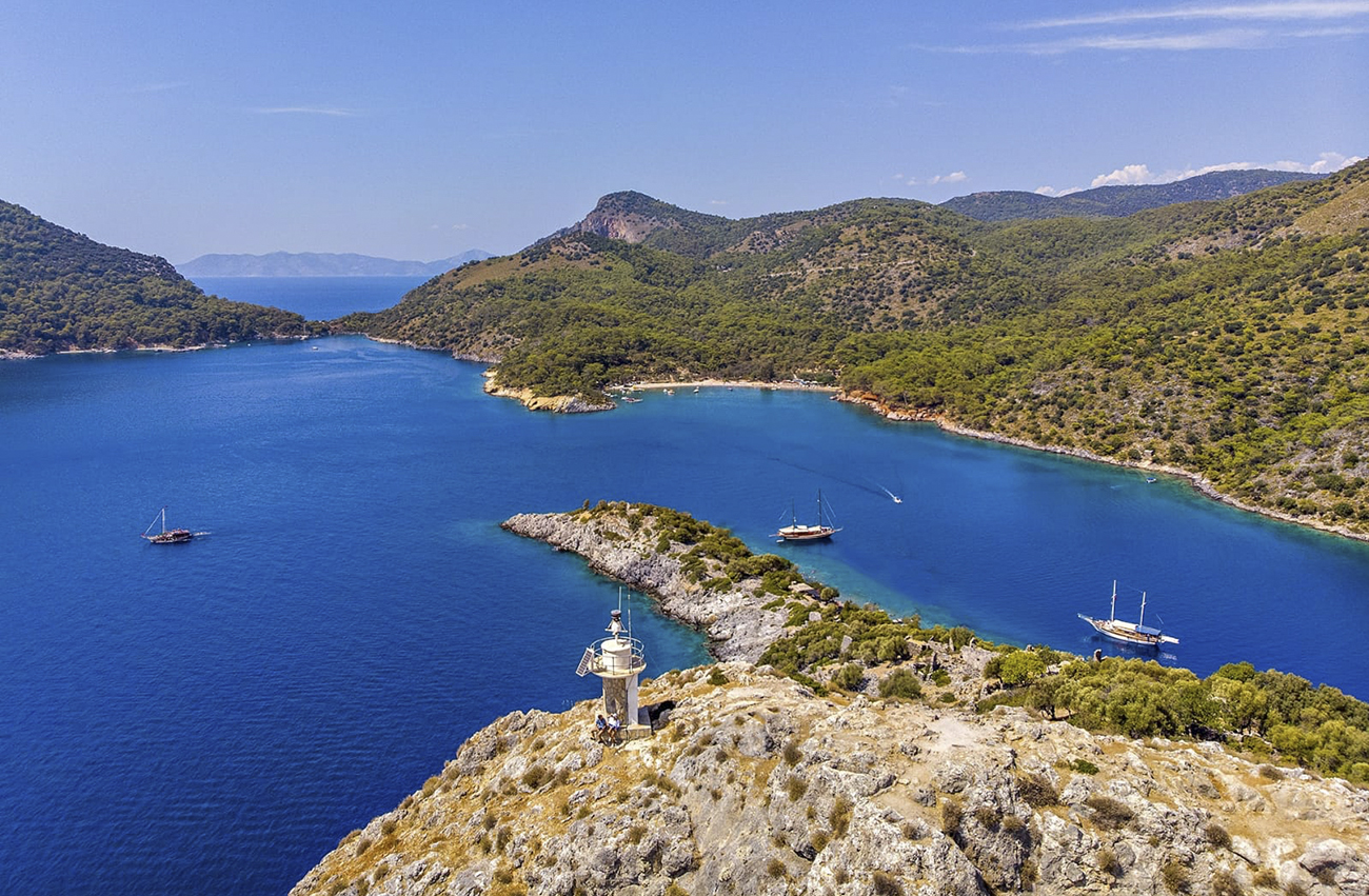
Today one can reach St Nicholas Island on one of the daily boat trips… Boats anchor for lunch off the main island, but do not stay long enough for exploration. Alternatively one can drive via Kaya village to the Gemiler beach and hire a boat to cross to the island…500 metres.
The island rears up 200 metres with steep inclines. Footwear is necessary as the limestone is rough. There is an entrance fee once one steps ashore.
Today one can reach St Nicholas Island on one of the daily boat trips…
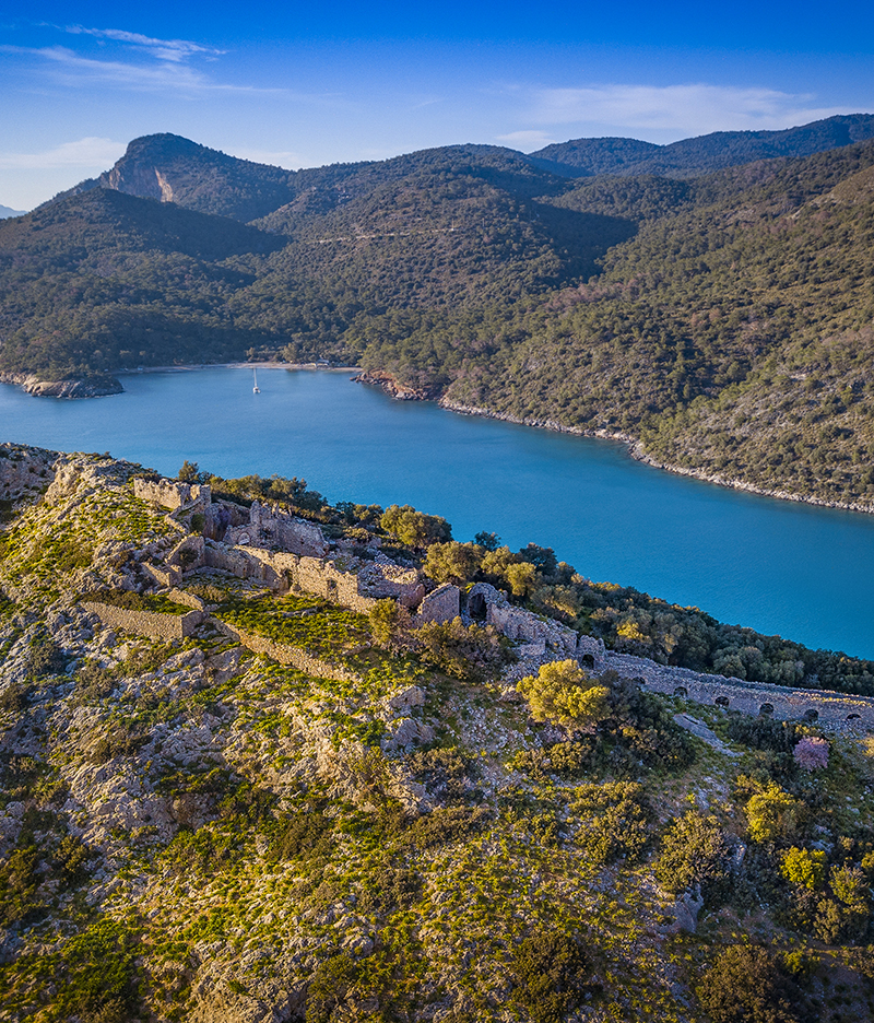
A path winds up the S.W. end of the island passing rows of dwellings which run along the shore-line half way up the island, where a wall separates off the upper religious section. Some of the upper dwellings still have two storeys, while buildings near the quays alternated with water cisterns which collected the rain water which flowed down channels between the dwellings.
Below, the quays now submerged in water extend 4-5 meters into the sea. Above the separating wall is la arger basilica partly built into the rock with 3 fine apse windows and an ambulatory. On the right one can make out the fresco of an angel, and Christ figure? when entering from the north. Continuing up the path are various types of graves, flat single burials, tunnel tombs with niches and rounded beehive tombs. The latter may have been stations of prayer. As one reaches the ridge one comes to a wide-stepped covered walkway which runs NW to SE 400 metres from Soguk Su up the ridge of the island terminating in the domed entrance to a small chapel originally dating to the 5th? century with a blind wall added later.
The covered way – a processional route…
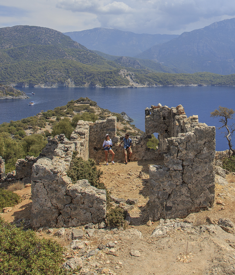
The main church at the top of the island…
The covered way still almost complete, was a processional route used by pilgrims? who crossed the sound immediately below. Levissi (now known as Soguk Su due to a fresh water channel running into the sea here). A few steps above the covered way one reaches the main church partly hewn out of the rock-bed. With marble screen and mosaic flooring, now open to the elements; it must have been a fine small basilica. Since excavation was carried out it is no longer possible to enter the church. Above are the remains of a clerical? building.The views from here are even more extraordinary. Oludeniz is hidden, but Kidrak beach and the Capes are in view.
A path winds up the S.W. end of the island passing rows of dwellings running along the shore line half way up the island, where a wall separates off the upper religious section. Some of the upper dwellings still have two storeys, while buildings near the quays alternated with water cisterns which collected the rain water which flowed down channels between the dwellings.
One concludes that the whole Oludeniz area up till the end of 7th C was a centre of Christian learning plus a stop-off for those on pilgrimages to the Holy Land… which terminated with invasions from the north Africa in the 680’s AD. The island lay in ruins for over 400 years until visited by trading sailors who re-instated at least the higher church. There is no history that inhabitants of Levissi later used the island except for fishing. Their business was out of the major port of Megri (formerly Telmessos and now Fethiye).

